Places
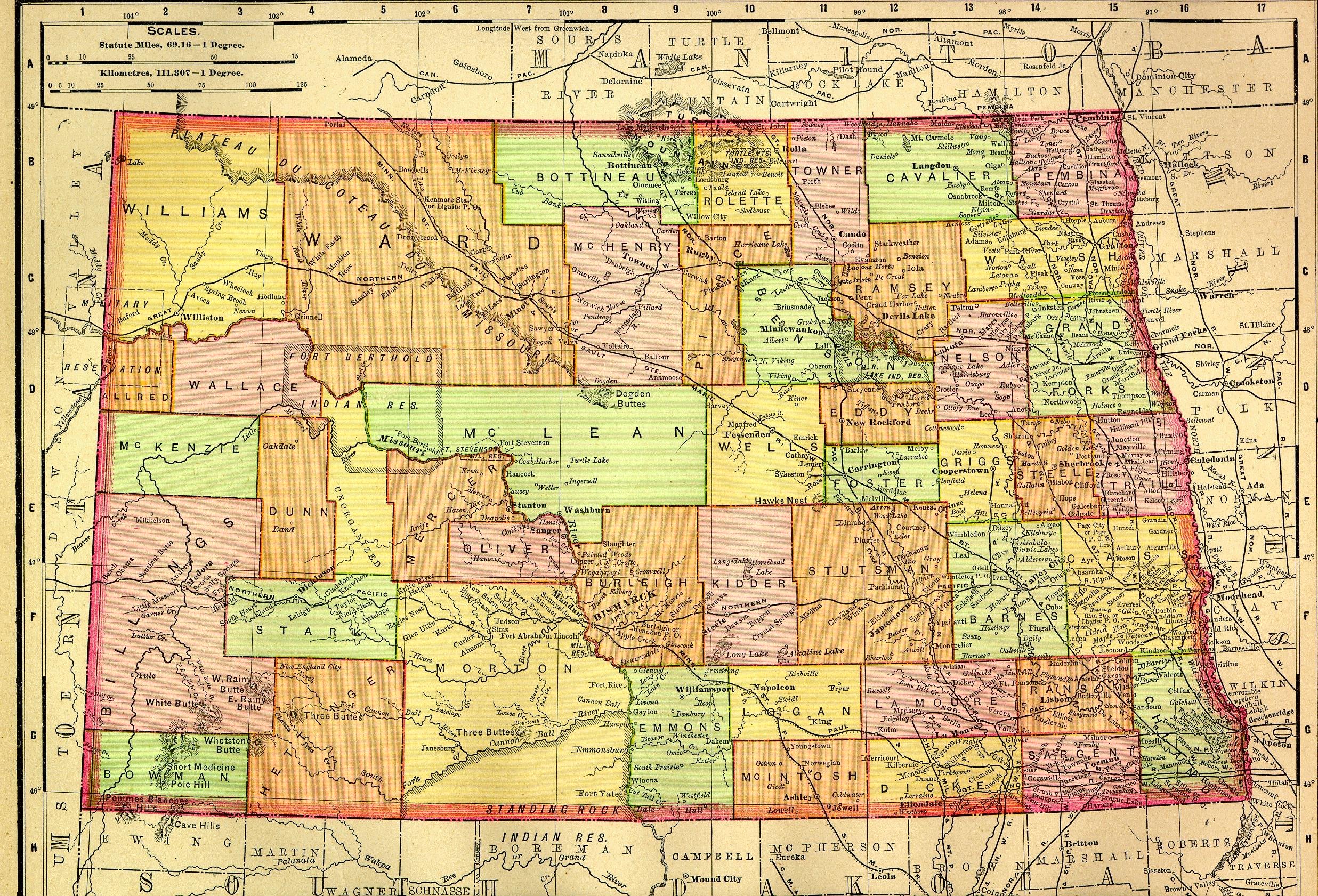
1895 Map

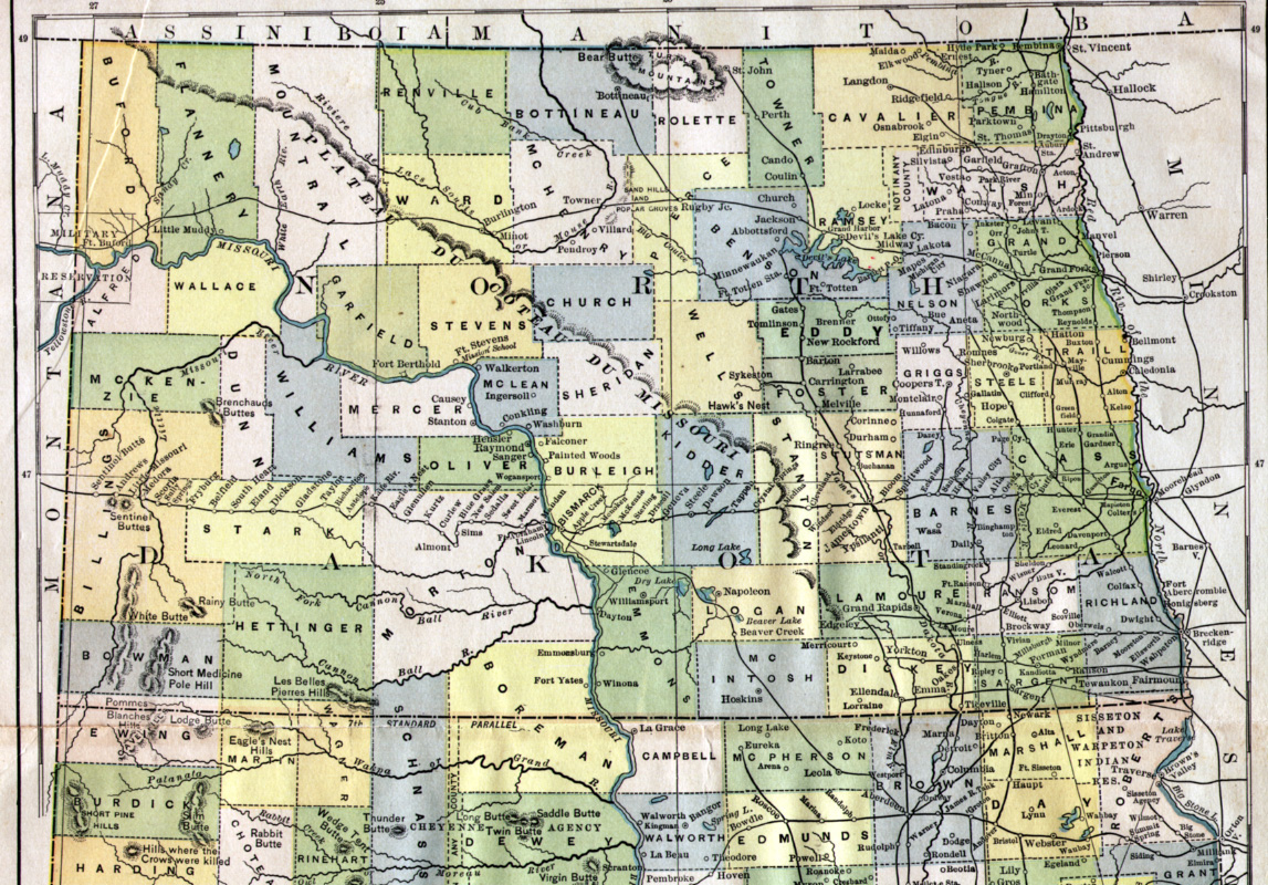
1888 Map
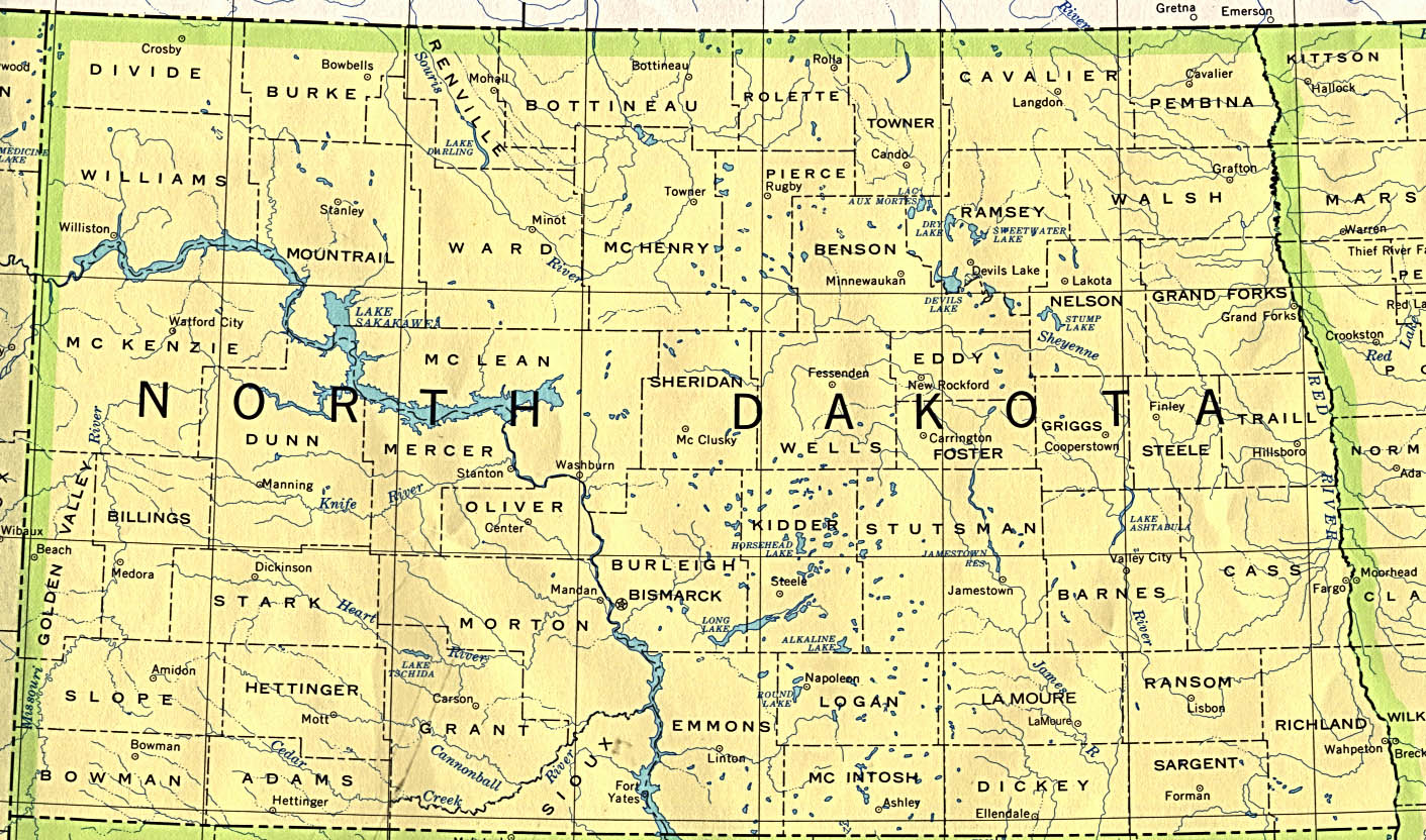
Modern
These data taken from the United States Geological Survey
(USGS) GNIS
database of populated places and are in the public domain.
They were
formatted for noncommercial use by Garnett J. Zsedeny.
Longitude and latitude are given so that locations can be plotted using the
Census Tiger Map Server, URL: http://www.census.gov/cgi-bin/gazetteer. The
best plots can be obtained with this system because with some effort local
roads down to the township level can be plotted making it easy to drive to
any place that roads allow. However, the latitude and longitude must be
converted to whole degrees and decimals versus degrees, minutes and
seconds used by the USGS. The conversion is degrees + minutes/60 +
seconds/3600. It can also be easily done using a scientific calculator.
City/Town/Village Latitude Longitude
-----------------
---------- ---------
Alpha
463930N 1034910W
Beach
465505N 1040014W
Chama
465428N 1035435W
De Mores
465519N 1034431W
Ekre
464721N 1035810W
Golva
464403N 1035909W
Rider
465451N 1033813W
Sentinel Butte 465506N 1035018W
Thelan
464813N 1035817W
Trotters
471923N 1035504W
Golden Valley County Townships
Extracted
from the Census Bureau databases, MCDS and Counties, by Garnett
J.
Zsedeny (1998) and is intended for noncommercial use only.
Beach
township
Golden Valley County
Bullion township
Golden Valley County
Delhi township
Golden Valley County
Elk Creek township
Golden Valley County
Elmwood township
Golden Valley County
Garner township
Golden Valley County
Henry township
Golden Valley County
Lone Tree township
Golden Valley County
Pearl township
Golden Valley County
Saddle Butte township Golden Valley County
Sentinel township Golden
Valley County